Not every building will have photos or articles, so a is a surefire way to document history and find people associated with the house is deed research, or tracing the house’s ownership back to the original owner. This is done by looking up the current owner’s deed of sale online. From there, the search is continued through the chain of grantees and grantors until the first one is found. It can be a bit tedious, but is worth it. This process is required for the aforementioned historic plaque application.
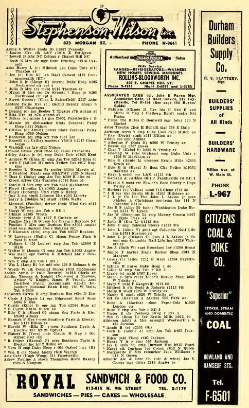
Equipped with a list of past owners, we then turn to the city directories to see if the owners were also the home’s occupants. Thanks to Durham’s universities and economic ups and downs, many single family houses in Durham served as rental properties, so have had a shocking number of inhabitants over the years. So where does one find a city directory? Digital NC has digitized versions of city directories, going all the way back to 1875. City directories of yore listed a person’s place of employment after their home address, so you can discover interesting tidbits beyond residents’ names.
We once dated a home’s second story addition by comparing addresses and occupants in a city directories. One year a new street number showed up in a city directory, with no corresponding building on a map, so we were able to deduce the date of the major addition.
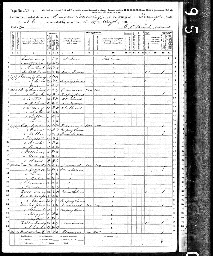
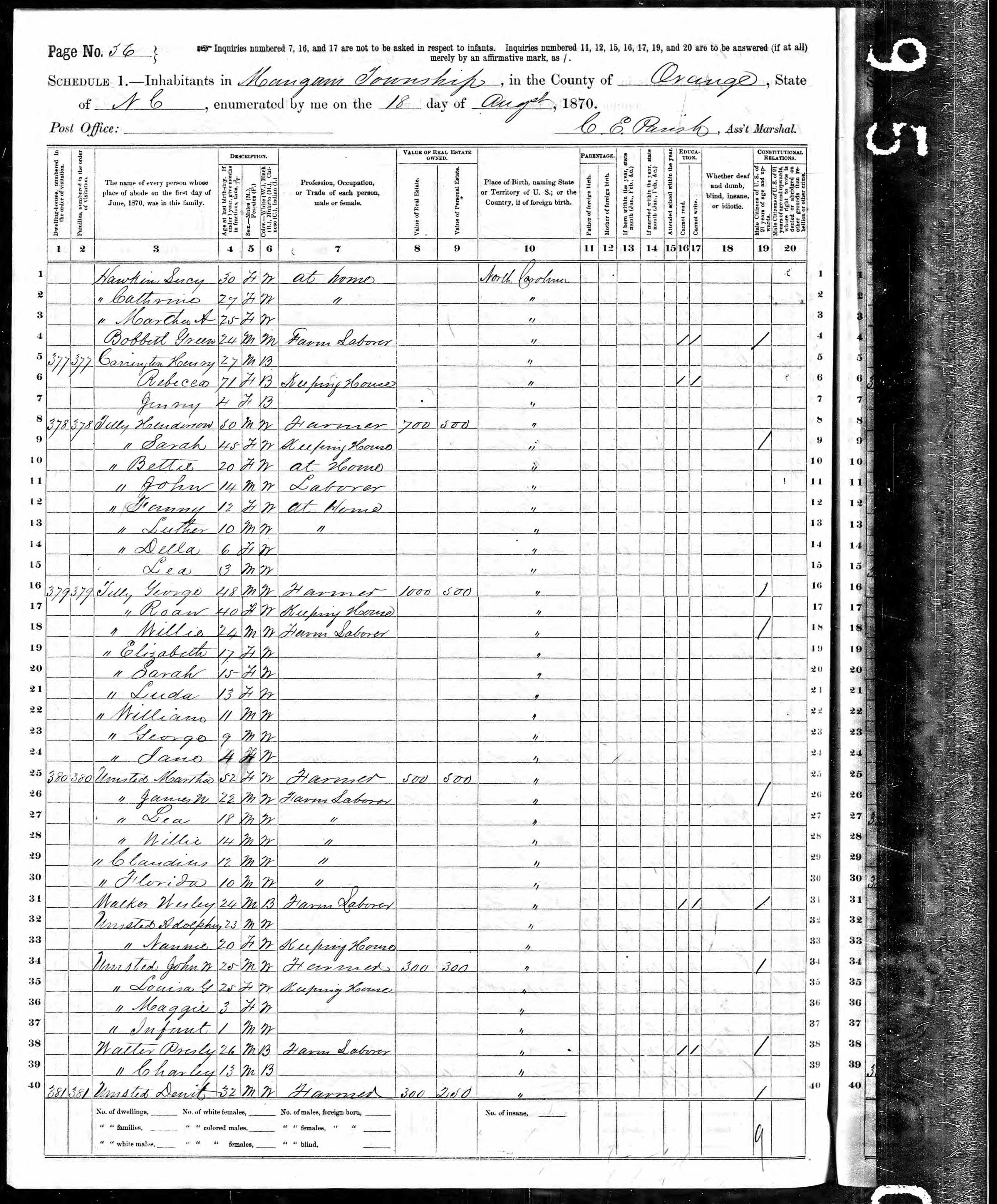
While city directories only list the homeowner and adult family members, census records show the entire household, including everyone’s ages. I’ve found that ancestry.com is the easiest way to look up individuals in the census records. Given changes to street names and numbers, misspellings of family names, and difficult handwriting from the past, this can be a tricky source to comb through.
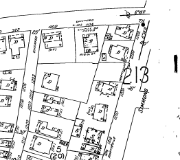
Sanborn Fire Insurance Maps are one of our personal favorite tools for research. (Some day, Emily hopes to wallpaper my bathroom in a huge Sanborn Map.) The maps were produced by the Sanborn Company to document buildings so that they could be accurately insured. Maps include information about a building’s use (residential or commercial), its building materials, and number of stories—all important things to know for liability reasons. Durham’s first Sanborn map dates to 1884, and expanded versions were published in 1888, 1893, 1898, 1902, 1907, 1913, 1937 and 1950. The maps can be accessed online through the Durham County Library with your library card number. Some maps can be found (in full color versions, to boot!) on UNC’s North Carolina Maps site. If these maps get you excited, check out this Chicago website, which places an overlay of Sanborn maps over current Google maps, and this project that researched the locations of theaters in Durham over the years.